

Tunnel – Made Possible by the Miracle of Dynamite
When we last left our intrepid adventurers they were sipping Starbucks and, from a safe distance, checking out enormous mines. https://gregole.com/2016/03/08/devils-highway-roadtrip-part-1/
But time had come to Enter the Devil’s Highway…
https://en.wikipedia.org/wiki/U.S._Route_191

They Rounded Down – It’s More
Morenci Mines / 305 PM / 5534 ft / 72 degrees / 210 miles
Passing thru the extremely cool dynamite-blasted tunnel, we put towns and people and cell-phone service and Starbucks behind us. And we had a plan.
See, a lot of people’s motivation to take a spin on 191 is purely to drive the highway and that’s fine – Google it and you’ll find a number of videos people have made by hanging a video camera out the window and just driving the curves for hours and you can watch, in some cases, the entire drive on your computer screen. I’ve scanned through a few to get a preview and it’s fascinating.
This was however, not our plan. We had something else in mind, and that’s that we had a recon mission planned; so never intended to just drive straight through, but planned on a (copious) number of stops along the way in order to inordinately snoop and spy and plot areas and trails to check out at a later date as this highway actually borders lots of amazing stuff. It is a destination in itself – drive the curves, check out the scenery; but it also goes to totally cool places you can get to by getting off the road and going to said cool places.
Here we go.
Besides the curvy remote road, it climbs from approximately 5500 feet above sea-level to over 9000 feet and heads roughly due north – so there’s a dramatic topography change and it gets colder. Recall the flora around Morenci…only a few minutes after the tunnel the road climbs and in no time we were in chaparral; it’s as if we were magically transported to Southern California!
Above Morenci / 3:20 PM / 5730 ft / 70 degrees / 217 miles
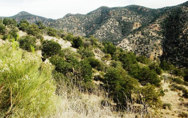
Minutes After the Tunnel
Our first planned stop was at the first developed campground, Granville Camp.
Granville Camp / 3:35 PM / 6488 ft / 64 degrees / 221 miles
As you can see, we are climbing in altitude and dropping in temperature. I had read on the internet of more than one motorcycle expedition that turned back simply due to cold as they gained altitude. We’ve had an unseasonably warm February. In other words, it’s been gorgeous; but it can get pretty cold in February and early March so for a bike tour probably better to schedule spring / summer.
Granville Campground. I was summarily unimpressed as far as Arizona campgrounds go. I mean it had all the amenities – potty, camp spots, fire-pits; you know, the basics. But it had a kind of cramped-in feel; it just didn’t turn me on. If you planned on over-nighting it, I’m sure it would be awesome; but Morenci is just down the road…why not just stay there and go to Starbucks in the morning? Maybe the locals use it to get out of town and in summer I’m sure it’s cooler. There. I answered my own question.
Couldn’t have been 15 more minutes on the road and we stopped for a cattle crossing – yes there are scattered ranches out there. Notice how much the vegetation has changed…from chaparral to forest in minutes.

Cattle Crossing and a Curious Calf
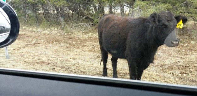
Cow #37
Our trip plan was simply to cruise the highway stopping along the way as we saw interesting stuff, and to stop at what looked like interesting stuff by inspecting Google Maps ahead of time. Here’s where we stopped:
Red Mountain Trail / 4:40 PM / 8305 ft / 55 degrees / 248 miles
Sheep Saddle Trail / 5:03 PM / 7386 ft / 57 degrees / 253 miles
Blue Vista / 5:34 PM / 9188 ft / 48 degrees / 265 miles
Here’s a photo montage:
Blue Vista seriously rocked! And yes, far enough up the mountain there was snow on the ground even though as I mentioned earlier, it has been warm and wonderful this last February here in beautiful Arizona. It is really remote up there and Gremlin and I noticed bear tracks too. Be careful out there!
We continued past Blue Vista and on to Hannigan Meadows headed for Springerville.

Next Stop Springerville
Hannagan Meadow / 6:15 PM / 8700 ft / 47 degrees / 272 miles
Springerville / evening / 6950 ft / 47 degrees / 323 miles
We had had quite the day! We checked into our hotel, went and had dinner at (the original) Los Dos Molinos and crashed for the night.
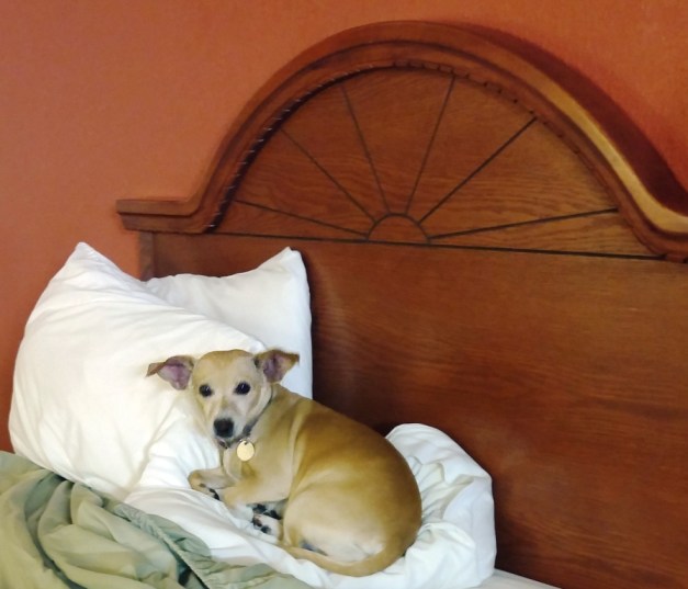
Dali Working on Her Chill

Blue Vista is amazing and of course, the doggie in bed really brings home how exhausting you day was!!!!
LikeLiked by 1 person
Blue Vista looks amazing!!
LikeLiked by 1 person
Thanks! And of course, there’s multiple trails, hikes you name it. At that point, we were in the White Mountains either bordering on or on the Apache Indian Reservation. But I’m a little bit afraid of bears up there but knowledgeable people tell me they are more afraid of us than we are of them!
LikeLike
Enjoyed this vicarious trip so much! Where was the cattle crossing?
LikeLiked by 2 people
Thanks for stopping by. The cattle were not too far up – just after Granville Campground. Glad you liked our little getaway slide show!
LikeLike